
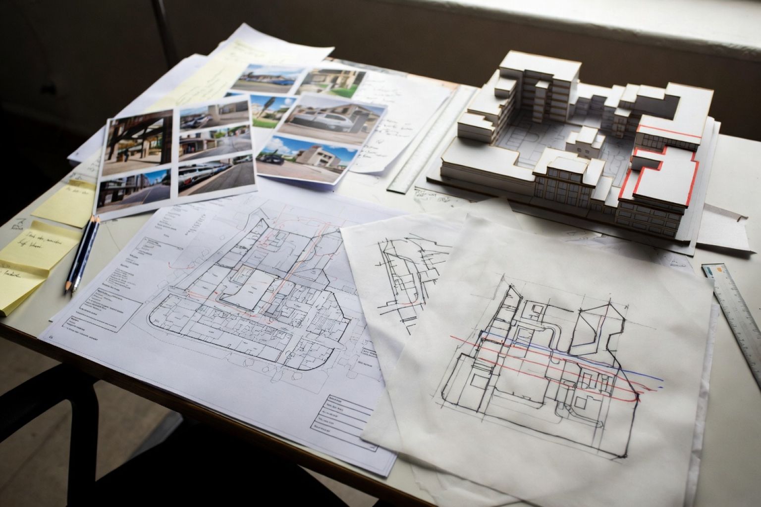
A city does not fail in one place.
It fails when housing, streets, transit, parks, schools, jobs, drainage, trees, and daily services stop working together.
That is the main planning problem.
A new apartment building does not help much if the nearest grocery store is a long drive away. A park does not work if it has no shade, no lighting, and no safe crossing. A transit stop does not work if the bus comes once an hour. A bike lane does not work if it ends at a dangerous intersection.
Urban planning is the work of connecting those pieces before damage spreads. If you are studying this from the design side, pair this page with Urban and Landscape Design Courses.
This is not about drawing a pretty master plan. It is about making daily life work: where people live, how they move, what they can afford, where water goes, how heat is handled, and who maintains the place after the ribbon-cutting.
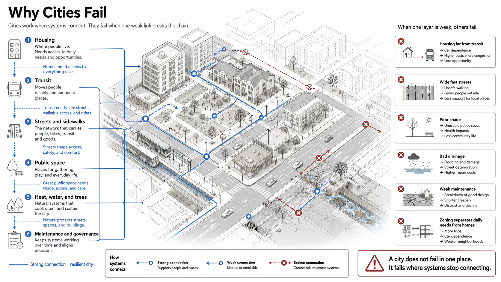
The City Fails When Systems Stop Connecting
Bad planning often looks small at first.
One missing sidewalk. One wide road with no safe crossing. One housing project far from transit. One park with no shade. One zoning rule that keeps shops away from homes. One drainage problem that floods the same corner every storm.
Then the problems stack.
| Weak link | What it causes | What people feel |
|---|---|---|
| Housing far from transit | More driving, more cost, less access | Long commutes and fewer job choices |
| Wide fast streets | Unsafe walking and biking | Parents drive short trips that should be walkable |
| Public space without shade | Empty parks during heat | The space exists, but people avoid it |
| Zoning that separates everything | Car dependence | Basic errands take too long |
| Weak maintenance | Broken lights, damaged benches, dead trees | A good plan starts feeling unsafe or neglected |
That is why planning has to be read as a system. A street is not only a street. It affects housing, safety, business, public space, heat, drainage, and who can move without a car. For the broader pressure around architecture and cities, read Architecture’s Hardest Problems.
What Urban Planning Actually Does
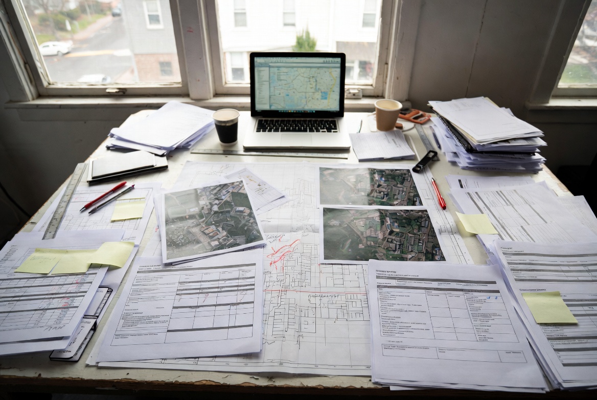
Urban planning decides how land, movement, buildings, services, and public space fit together. Before a plan is trusted, the work has to start with site analysis, not a finished image.
It affects who can live in a place, how far people travel, where shops can open, how streets are designed, where schools and parks go, and how a city handles growth.
Planning also decides what gets protected.
That can mean old neighborhoods, farmland, floodplains, transit corridors, public waterfronts, tree canopy, affordable housing, or industrial land that still supports jobs.
A good plan answers plain questions:
- Can people reach daily needs without a long drive?
- Can different income levels live there?
- Can children, older adults, and disabled people move safely?
- Can the city maintain what it builds?
- Can the area handle heat, storms, flooding, and future change?
If the plan cannot answer those questions, the render does not matter much.
Start With The Street, Not The Skyline
The street is where city planning becomes real.
People do not experience zoning maps first. They experience the walk to the bus stop, the crossing at the corner, the noise of traffic, the lack of shade, the empty storefront, the broken curb ramp, or the dark path home.
NACTO describes streets as a major part of public space in cities. That matters because streets are not just traffic pipes. They are where people walk, wait, shop, sit, cross, bike, drive, take transit, and meet each other.
A working street usually has a few basic things:
- safe crossings at the places people actually cross
- sidewalks that connect instead of ending suddenly
- trees, shade, lighting, and places to pause
- speeds low enough that a mistake is less likely to kill someone
A city can spend millions on a new district and still fail if the street does not work. For a clearer urban-design checklist, use the 5 points of urban design and Kevin Lynch’s 5 elements of the city.
Housing Only Works When Daily Life Is Nearby
Housing is not only a unit count.
A city can approve many new homes and still make life hard if those homes sit far from jobs, schools, transit, parks, food, clinics, and basic services.
The question is not only “How many units?”
The better question is “What kind of life does this location create?”
| Housing decision | Better planning question | Risk if skipped |
|---|---|---|
| New apartments | Are transit, food, school, and parks close enough? | More car trips and higher living costs |
| Affordable housing | Is it near real opportunity? | Cheap rent but expensive daily life |
| Higher density | Are light, air, services, and open space handled? | Crowding without quality |
| Redevelopment | Who gets displaced, and where do they go? | Growth that pushes out the people it claims to serve |
Housing policy and land-use planning cannot be separated. If they are separated, the city gets units without access. For the housing side of the cluster, see Housing Concepts and Healthy Sustainable Housing.
Transit Has To Be Useful Before People Give Up Cars
Transit does not work because it exists on a map.
It works when it is frequent, safe, direct, readable, and close enough to use without planning the whole day around it.
A bus that comes every 45 minutes is not the same as a bus that comes every 10 minutes. A station with no safe walking route is not really accessible. A transfer that takes 18 minutes in the rain is a tax on the rider.
Useful transit needs the land around it to cooperate:
- homes close enough to walk to the stop
- shops and jobs near routes
- safe crossings around stations
- sidewalks, lighting, bike parking, and clear signs
Transit planning fails when it is treated as a line on a map instead of a daily door-to-door trip. The same logic matters in spatial planning and design, where routes, edges, services, and daily use have to work together.
Public Space Needs Care, Not Just Open Land
A patch of grass is not automatically a public space.
A plaza is not successful because it photographs well. A park is not inclusive because it is colored green on a plan. A waterfront is not public if it feels controlled, watched, expensive, or hard to reach.
Useful public space needs ordinary things:
- shade
- seating
- lighting
- safe crossings
- nearby activity
- clear maintenance
UN-Habitat’s public-space work focuses on the supply, quality, distribution, access, and management of public space. That last word matters: management. A public space that no one maintains will not stay public in any useful sense. For city design that uses trees, shade, and daily comfort as part of the system, read Biophilic Cities.
Zoning Can Protect A City Or Freeze It In The Wrong Shape
Zoning is not only a technical map.
It decides what can be built, where it can be built, how much parking is required, how tall buildings can be, how close they sit to the street, and whether homes, shops, services, and jobs can mix.
Some zoning protects health and safety. Some protects older neighborhoods from careless change. Some protects industrial land that a city still needs.
But zoning can also freeze bad patterns.
It can separate homes from stores. It can require too much parking. It can block small apartments. It can make corner shops illegal. It can push growth to the edge of the city, where every trip needs a car.
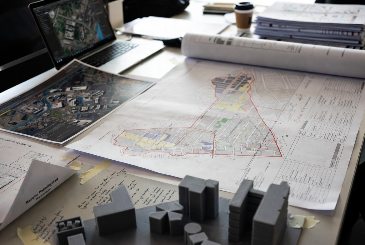
A simple zoning check should ask:
- Does the rule support daily life, or only protect a past pattern?
- Does it allow enough housing types?
- Does it make walking and transit easier or harder?
- Does it add cost that does not improve safety or quality?
Zoning is useful when it guides change. It becomes a problem when it blocks the city from fixing itself. For a wider beginner path around design decisions, use Understanding Design Thinking in Architecture.
Planning Materials That Move The Work Forward
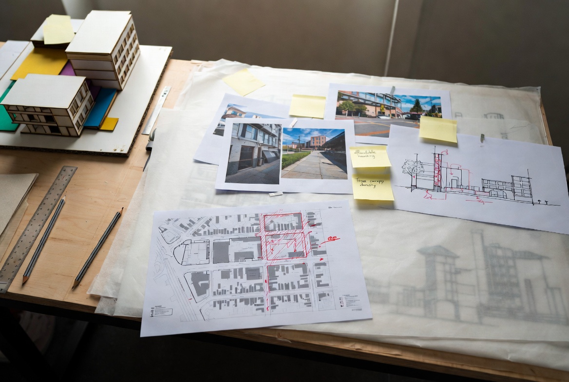
Real planning work is not one clean drawing.
It is a stack of maps, notes, studies, meetings, trade-offs, and revisions. The work looks slow because the city is not one client. It is many users, agencies, owners, rules, budgets, and risks.
Good planning materials should show:
- existing conditions, not only the proposed dream
- land use and zoning limits
- transit, walking, biking, and driving patterns
- flood, heat, tree canopy, and stormwater issues
- housing need and displacement risk
- what changes first, second, and later
A plan gets weaker when those layers are hidden. It gets stronger when the trade-offs are visible. For broader site-scale reading, use Macro Site Analysis.
Heat, Water, And Trees Are Planning Issues Now
Heat is not just a weather problem.
It is a planning problem. Pavement, dark roofs, traffic, lack of trees, weak shade, poor ventilation, and long walks to transit all make heat worse.
Water is the same.
A city that covers too much land with hard surfaces has to send stormwater somewhere. If drains are undersized, creeks are buried, and floodplains are built over, the water still comes back. It just comes back as damage.
Trees are not decoration in this system.
They cool streets, slow runoff, improve comfort, support public space, and make walking more possible. But trees need soil volume, water, maintenance, and protection from construction damage. Planting them on a plan is easy. Keeping them alive is the planning test. For the larger environmental link, read Impact of the Built Environment on the Natural Environment.
Smart-City Tools Do Not Fix Dumb City Decisions
Sensors, dashboards, cameras, traffic data, and AI tools can help a city understand patterns.
They cannot decide what the city should value.
A smart parking system does not fix a city that requires too much parking. A traffic dashboard does not fix a street that is dangerous by design. A public feedback app does not help if the same residents are always ignored.
Technology is useful when it answers a clear planning question:
- Where are crashes happening?
- Which bus stops are overcrowded?
- Which sidewalks fail during snow, heat, or rain?
- Which public spaces are unused, and why?
The tool should lead to a decision. If it only makes a dashboard, it is not planning. For the architecture side of digital tools, read How Architects Use AI.
Where Good Plans Fail After Opening Day
Many plans look best before anyone uses them.
Then daily life starts.
Delivery trucks block the bike lane. The new trees do not get watered. The plaza has no shade at lunch. The public bathroom closes because no one funded cleaning. Benches break. Lights fail. Snow piles up at curb ramps. A ground-floor retail space sits empty because the rent is too high.
None of that is a surprise if the plan was honest.
A good plan should name who maintains the public space, who pays for repairs, who clears snow, who waters trees, who manages events, who responds to safety problems, and who changes the plan if people do not use it.
| After opening | Planning question | If no one owns it |
|---|---|---|
| Trees and planting | Who waters and replaces them? | Dead planting and hotter streets |
| Lighting | Who repairs outages fast? | Unsafe paths and empty public space |
| Public toilets | Who cleans and funds them? | Closed facilities or poor conditions |
| Bike lanes and curbs | Who manages loading and enforcement? | Blocked lanes and unsafe movement |
| Ground-floor space | Can local businesses afford it? | Dead frontage and less street life |
Opening day is not the finish line. It is when the planning starts getting tested. That same long-term test appears in the built environment as a social determinant of health.
What Architects Should Check Before Designing One Building
Architects work on buildings, but every building lands inside a city system.
Before fixing the form, check the block.
- Walk the site at more than one time of day.
- Watch how people actually cross, wait, park, bike, and use the edges.
- Check transit frequency, not only distance to the stop.
- Look for shade, heat, wind, drainage, and flood risk.
- Read the zoning and approval path early.
- Ask what the ground floor gives back to the street.
- Find out who may be displaced or priced out.
- Ask who maintains the public-facing parts after construction.
A building can be good on its own and still make the street worse. That is the danger. For the building-design side of this problem, read Architectural Form Examples.
Urban Planning Mistakes That Keep Cities Broken
| Mistake | Why it hurts | Better move |
|---|---|---|
| Planning around cars first | Walking, biking, transit, safety, and local business suffer | Design streets for all users, then manage car movement |
| Separating every use | Daily life spreads too far apart | Allow homes, shops, schools, services, and jobs closer together |
| Calling every open area public space | Empty plazas and unsafe parks get counted as success | Check access, comfort, shade, seating, safety, and maintenance |
| Adding equity at the end | Displacement and unequal access are already built into the plan | Check affordability, access, voice, and risk from the start |
| Trusting tech over local knowledge | Data misses what residents already know | Use data and local feedback together |
| Ignoring maintenance | Good design decays into broken infrastructure | Fund care, repair, cleaning, watering, lighting, and enforcement |
Before You Move On
Urban planning is not the art of making a city look finished.
It is the work of making daily life possible.
Streets, housing, transit, trees, water, parks, zoning, safety, and maintenance all have to carry each other. When one part breaks, the city feels it.
That is why good planning starts with connections, not skylines.
FAQ
What is urban planning?
Urban planning is the work of organizing land, housing, streets, transit, public space, services, infrastructure, and growth so a city can function.
Why do cities fail?
Cities usually fail when systems stop connecting. Housing may be far from transit. Streets may be unsafe. Public spaces may be unused. Zoning may block daily needs. Maintenance may be missing.
What are the main parts of urban planning?
The main parts include land use, housing, transportation, public space, infrastructure, zoning, climate resilience, economic development, community engagement, and maintenance.
Why does walkability matter?
Walkability lowers daily friction. It helps people reach transit, food, parks, schools, shops, and services without needing a car for every trip.
Is density bad?
No. Bad density is the problem. Density needs light, air, trees, services, transit, good street design, and enough public space.
What makes public space work?
Public space works when it is easy to reach, safe, shaded, comfortable, active, maintained, and useful to different people at different times of day.
Can smart-city technology fix urban problems?
Not by itself. Technology can help measure problems, but planning still needs policy, funding, local knowledge, design judgment, and maintenance.
What should architects understand about urban planning?
Architects should understand that one building affects streets, movement, shade, safety, housing, public space, drainage, and daily life around it.
Read This Next
Read Urban and Landscape Design Courses if you want the course path behind planning, landscape, streets, and public space.
Use What Are the 5 Points of Urban Design? for a shorter urban design framework.
Read Kevin Lynch’s 5 Elements of the City if you want a clearer way to read paths, edges, districts, nodes, and landmarks.
Read Architecture’s Hardest Problems for the broader link between buildings, cities, climate, cost, and practice.
Use Biophilic Cities if heat, trees, shade, public space, and urban comfort are the main issue.
Read Sustainable Architecture Degrees if climate, buildings, and city performance are your main study interest.